The southwesterlies enhanced by Tropical Storm “Maring” will bring moderate to heavy rains over Western Visayas and other parts of the country, based on the weather bulletin issued by Philippine Atmospheric, Geophysical and Astronomical Services Administration (PAGASA) on Sunday morning.
Flash flooding and rain-induced landslides are possible especially in areas that are highly or very highly susceptible to these hazards, according to PAGASA.
In preparation for the weather disturbances, the Office of the Civil Defense 6 conducted a briefing with concerned agencies and local government units (LGUs).
OCD 6 Operations Section Chief Melissa Banias reported that no significant incident was monitored as of Sunday morning, except for the tornado in Sigma, Capiz last Saturday.
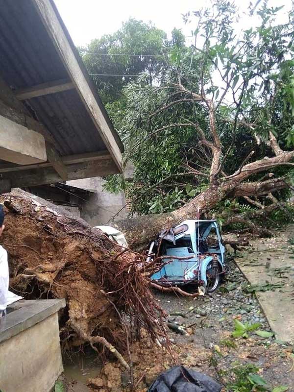
Two houses and a tricycle were damaged when a tornado occurred Saturday afternoon at Purok 2 in Barangay Mangoso, Sigma, Capiz.
Punong Barangay Monico Jubal Obien said they were shocked when the tornado struck in the middle of heavy rains.
The strong wind dismantled parts of the houses of Danilo Antonio and Hermoso Gregorio while the garage of Ramonito Candido got separated from the main house.
The tricycle of Gilbert Mondido was damaged by a fallen mango tree. He added that their rice crops that were ready for harvest were also destroyed.
No one was injured in the incident.
Meanwhile, Regional Disaster Risk and Reduction Management Council (RDRRMC) chairman, OCD 6 Director Jose Roberto Nuñez, appealed to the public to stay alert and not be complacent in the midst of the typhoon.
He also reminded the public and concerning agencies the observance of health protocols in the DRRM Plans and Response amid the Covid-19 pandemic.
PAGASA monitored the center of Tropical Storm “Maring” based on all available data at 645 km East of Tuguegarao City, Cagayan or 655 km East of Aparri, Cagayan with a maximum sustained winds of 85 km/h near the center, gustiness of up to 105 km/h, as of 5 p.m. of Sunday.
TS Maring is forecasted to accelerate and move northwest over the Philippine Sea notwithstanding possibility of short-term erratic motion. Afterwards, TS will turn and move west northwestward towards extreme Northern Luzon and is expected to be outside of Philippine Area of Responsibility on October 13. (ERS and Felipe V. Celino )


