By Rjay Zuriaga Castor
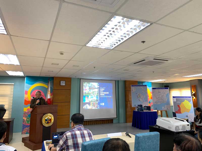
The Iloilo City government is advancing its earthquake preparedness and risk management with the creation of the first city-wide seismic hazard and building risk assessment book which can assist engineers in designing earthquake resilient buildings and structures.
The scientific publication launched on Friday was developed in collaboration with the Department of Science and Technology – Philippine Institute of Volcanology and Seismology (DOST-PHIVOLCS).
The collaboration started in June 2021 and included the probabilistic hazard modeling, exposure database field validation, and initial building risk assessment. In December 2022, the technical writing of the publication was finalized.
Divided into two volumes, the publication includes technical reports on seismic risk assessment, potentially affected buildings, and expected structural losses of assessed buildings.
“We saw how important it is. We saw how significant it is in the operation most especially in disasters. I know it would be very important to the Office of the Building Officials (OBO),” said Iloilo City Mayor Jerry Treñas, who was represented by his special assistant Francis Cruz.
Treñas furthered that the data models and assessment will aid the local government in their respective disaster risk reduction and management offices.
“The private sector and also those in the engineering and insurance industry will make informed decisions in advancing earthquake preparedness and risk management,” the city mayor added.
DOST-PHIVOLCS Director Teresito C. Bacolcol said the maps will serve as a guide to engineers and architects to enhance infrastructure resilience and support proactive urban planning and long-term development.
“These maps can also be used to enhance disaster risk reduction and management strategies and as well as facilitate recovery and business continuity after a devastating earthquake,” Bacolcol added.
Bacolcol, however, noted that DOST-PHIVOLCS and OBO only assessed structures with building permits from 2015 to the present. It is composed of 4,735 building assets.
Based on the city’s building portfolio, structural losses can reach greater than Php1 billion.
Bacolcol has encouraged building owners to file for building permits to ensure safety and quick recovery during and after a destructive earthquake.
The hazard map showed that areas in the western part of the city are at a higher risk for damage from an earthquake with an intensity VIII due to its proximity to the West Panay fault.
“We are imploring people na when you build in the future and currently… na kung magbubuild ka ng structure, you follow the standards of the National Building Code of the Philippines,” an engineer from DOST-PHIVOLCS said.
The map will be updated every 5 years according to DOST-PHIVOLCS and OBO.


